Bargarh is a district on the Western border of Orissa. Prior to 1992, it was a subdivision of Sambalpur district. Bargarh District formed on the 1st April 1993 being devided from Sambalpur District. It is one of the illustrious District of Odisha. Bargarh has been named after the headquarters town Bargarh situated on the left bank of the Jirariver. The town is on the National Highway No.6 and located at 59 km to the west of Sambalpur district. It is also served by the D.B.K railway running from Jharsuguda to Titlagarh. The railway station is about 3 kms off the town. A meter gauge railway line connects Bargarh with the lime stone quarry at Dunguri. The main Hirakud canal passes through the town and is known as the Bargarh canal.
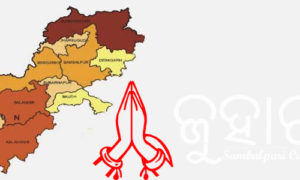
Bargarh District lies on the western most corner of Odisha between 20 degree 43’ to 21 degree 41’ north latitude and 82 degree 39’ to 83 degree 58’ east longitude. The District is surrounded by Chhatisgarh state on the north, Sambalpur District on the east, Balangir and Subarnapur on the south and Nuapada District on the west.
The original name of the place was Baghar Kota as known from the inscription of the 11th century AD. It was called Bargarh probably from the time of BalaramDev the first Chouhan Raja of Sambalpur who made it his head quarters for some time and constructed a big fort for it’s protection. Narayan Singh the last Chouhan Raja granted this place in Mauzi (free hold) to two Brahmin brothers Krushna Das and Narayan Das, sons of Baluki Das who was killed in action by the Gond rebels led by Bandhy Ray and Mahapatra Ray. The grant is popularly known as Sira-kata(head-cutting) grant.
To know the history of the newly formed Bargarh district one cannot ignore the history of undivided Sambalpur district, because Bargarh was one of the subdivisions of old Sambalpur district. This district lies at the close proximity of Sambalpur subdivision separated by the Mahanadi river. The Chouhans,were the most powerful and ruled over a cluster of 18 states in western Orissa and eastern part of Madhya Pradesh. The Chauhan states which crumbled by the British Imperialism, lapsed to the East India Company in 1849 when the last Raja Narayan Singh died without any issue. The Principal Assistant of the British Agent for the south east frontier having his headquarters at Ranchi took over the rein of administration of these states.
Prior to 1905, Sambalpur and Bargarh sub- divisions were part of present Chhatisgarh state (erstwhile Central province). In 1936, separate province of Orissa was formed. In the year 1948, the ex-state areas of Bamra and Rairakhol were added to the district of Sambalpur. In the year 1969 a new sub-division, Padmapur was created constituting the areas of Bijepur,Gaisilet, Jagadalpur, Melchhamunda, Padmapur, Paikamal and Sohela Police Stations of old Bargarh sub-division.
Keeping the smooth administration and effective implementation of developmental programmes in view, 13 districts of Orissa were divided into 30 districts in the years 1992,1993 and 1994. By this process, the erstwhile Sambalpur district was divided into four districts namely Sambalpur,Jharsuguda, Bargarh and Debagarh. Bargarh district was carved out taking the areas of two sub-divisions, namely, Bargarh and Padmapur from the erstwhile district of Sambalpur as per the Government of Orissa Notification No.14218/R. dated 27.03.1993. The area of Sambalpur district was 17516.00 sq.km as per the 1991 Census and that of Bargarh was 5831.57 sq.km. As such, Bargarh district holds 33.29 percent of the total area of undivided Sambalpur district.

